
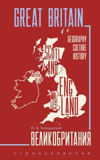
Великобритания : Пособие по страноведению
Покупка
Новинка
Издательство:
КАРО
Автор:
Голицынский Юрий Борисович
Год издания: 2025
Кол-во страниц: 480
Дополнительно
Вид издания:
Учебное пособие
Уровень образования:
Дополнительное образование детей
ISBN: 978-5-9925-1956-3
Артикул: 898668.01.99
Доступ онлайн
350 ₽
В корзину
Учебное пособие по страноведению «Великобритания» позволяет познакомиться с жизнью в этой стране, а вместе с тем существенно повысить уровень владения английским языком. В книге Вы найдете изложенные доступным языком сведения об истории, географии, политическом устройстве, крупных городах, достопримечательностях, известных британцах, флоре и фауне и т. д.
Закрепить изученный материал можно с помощью вопросов после каждой части и заданий после каждой главы. Для удобства работы с пособием представлен подробный словарь.
Пособие предназначено для учащихся старших классов гимназий и школ с углубленным изучением английского языка.
Тематика:
ББК:
УДК:
- 373: Дошкольное воспитание и образование. Общее школьное образование. Общеобразовательная школа
- 80: Общие вопросы филологии, лингвистики и литературы. Риторика
ОКСО:
- ВО - Бакалавриат
- 05.03.02: География
- 45.03.02: Лингвистика
ГРНТИ:
Скопировать запись
Фрагмент текстового слоя документа размещен для индексирующих роботов
Голицынский Ю. Б.
ISBN 978-5-9925-1956-3 УДК 373.167.1:802.0 ББК 81.2 Англ922 Г60 Голицынский, Юрий Борисович. Г60 Великобритания : Пособие по страноведению / Ю. Б. Голицынский : [3-e изд., испр.] — СанктПетербург : КАРО, 2025. — 480 с., ил. ISBN 978-5-9925-1956-3. Учебное пособие по страноведению «Великобритания» позволяет познакомиться с жизнью в этой стране, а вместе с тем существенно повысить уровень владения английским языком. В книге Вы найдете изложенные доступным языком сведения об истории, географии, политическом устройстве, крупных городах, достопримечательностях, известных британцах, флоре и фауне и т. д. Закрепить изученный материал можно с помощью вопросов после каждой части и заданий после каждой главы. Для удобства работы с пособием представлен подробный словарь. Пособие предназначено для учащихся старших классов гимназий и школ с углубленным изучением английского языка. УДК 373.167.1:802.0 ББК 81.2 Англ922 © КАРО, 2025 Все права защищены
The United Kingdom of Great Britain and Northern Ireland —
Îáúåäèíåííîå êîðîëåâñòâî Âåëèêîáðèòàíèè è Ñåâåðíîé
Èðëàíäèè
 2	 the British Isles — Áðèòàíñêèå îñòðîâà
 3	 Europe — Åâðîïà
 4	 the English Channel — ïðîëèâ Ëà-Ìàíø
 5	 the Strait of Dover — ïðîëèâ Па-де-Кале
 6	 the North Sea — Ñåâåðíîå ìîðå
SECTION ONE
GENERAL INFORMATION
CHAPTER 1
GEOGRAPHICAL SURVEY
Part 1. Geographical Position
The United Kingdom of Great Britain and Northern
Ireland1  is situated on the British Isles2  — a large group
of islands lying off the north-western coast of Europe3
and separated from the continent by the English Channel4
and the Strait of Dover5  in the south and the North Sea6
in the east.
The British Isles consist of two large islands — Great
Britain and Ireland — separated by the Irish Sea1 , and a lot
of small islands, the main of which are the Isle of Wight2
in the English Channel, Anglesea3  and the Isle of Man4
in the Irish Sea, the Hebrides5  — a group of islands off
the north-western coast of Scotland6 , and two groups of
islands lying to the north of Scotland: the Orkney Islands7
and the Shetland Islands8 .
Historically the territory of the United Kingdom is
divided into four parts: England9 , Scotland, Wales10  and
Northern Ireland.
 1	 the Irish Sea — Èðëàíäñêîå ìîðå
 2	 the Isle of Wight — îñòðîâ Óàéò
 3	 Anglesea — Ýíãëñè
 4	 the Isle of Man — îñòðîâ Ìýí
 5	 the Hebrides — Ãåáðèäû
 6	 Scotland — Øîòëàíäèÿ
 7	 the Orkney Islands — Îðêíåéñêèå îñòðîâà
 8	 the Shetland Islands — Øåòëàíäñêèå îñòðîâà
 9	 England — Àíãëèÿ
 10	 Wales — Óýëüñ
The Isle of Wight
The total area of the United Kingdom is 242,495 square
kilometres.

1.	 Where is the United Kingdom of Great Britain and
Northern Ireland situated?

2.	 Which waters separate the British Isles from the
continent of Europe?

3.	 What islands do the British Isles consist of?

4.	 Which four parts is the territory of the United
Kingdom historically divided into?

5.	 What is the total area of the United Kingdom?
Part 2. Nature
Great Britain is situated in the temperate zone of
Europe. The nature of Great Britain is greatly affected by
the sea: there is no place situated more than 100–120 km
from the seashore, in the northern parts only 40–60 km.
The territory of Great Britain can be divided into three
natural regions:
1) Scotland with highland and upland relief and coniferous and mixed forests;
2) Wales and mountainous England with upland considerably cut by ravines and valleys and covered with meadows, moorland1  and cultivated farmland, with patches
of broadleaf forest;
3) South-east England with plain landscape, fertile
soils, the predominance of cultivated farmland, with
patches of broadleaf forest.
1	 moorland — ïóñòîøü, ïîðîñøàÿ âåðåñêîì
1.	 What natural zone is the United Kingdom situated in?

2.	 What factor is the nature of Great Britain affected
by? Why?

3.	 What natural regions can the territory of Great
Britain be divided into?
Part 3. Coasts
The coastline of Great Britain is greatly indented, especially in the west and north-west where the mountains
come close to the coast. The coasts of Scotland, as well
as the coasts of the Hebrides, the Orkney Islands and the
Shetland Islands, are cut by numerous fiords. In the south
and east the land gradually slopes down towards the sea,
The coast of Britain
and the coasts are sandy and gentle, here and there interrupted by the ends of hill-ranges, which form low cliffs.

1.	 Why is the coastline of Great Britain especially
greatly indented in the west and north-west?

2.	 Where are fiords especially numerous?

3.	 How do the southern and eastern coasts of Great
Britain differ from the western and north-western
coasts?
Part 4. Relief
The general slope of the land is from north-west to
south-east.
The mountains cover the greater part of northern,
western and middle Great Britain. They can be divided
into the following groups:
1) The Highlands of Scotland1  occupy most of the land
to the north-west of a line drawn from Glasgow2  to Aberdeen3 . Two parts of the Highlands — the North-western
Highlands4  and the Grampians5  — are separated by a
narrow valley, through which runs the Caledonian Canal6 .
At the south-western end of the Highlands rises Ben Nevis7 ,
1344 m, the highest mountain of the British Isles.
1	 The Highlands of Scotland — ñåâåðíàÿ âûñîêîãîðíàÿ ÷àñòü
Øîòëàíäèè
2	 Glasgow — Ãëàçãî
3	 Aberdeen — Аáåðäèí
4	 the North-western Highlands — Ñåâåðî-çàïàäíàÿ ÷àñòü
âûñîêîãîðíîé Øîòëàíäèè
5	 the Grampians — Ãðàìïèàíñêèå ãîðû
6	 the Caledonian Canal — Êàëåäîíñêèé êàíàë
7	 Ben Nevis — Áåí-Íåâèñ
2) The Central Plain of Scotland1  separates the Highlands
from the Southern Uplands of Scotland2 . The Southern
Uplands and the Pennines3 , which stretch in the northsouth direction across the northern and middle parts of
England, form a practically continuous group.
3) Nearly the whole of Wales is occupied by the Cumbrians4 . The highest peak of the Cumbrians is Snowdon5 , 1085 m.
The south-eastern part of England is lowland, interrupted in places by low chalk ridges.
QUESTIONS:

1.	 What is the general slope of the land in Great
Britain?

2.	 Which three groups can the mountains be divided
into?

3.	 Where are the Highlands of Scotland situated?

4.	 Which are the two parts of the Highlands? What
are they separated by?

5.	 Which is the highest mountain of the British Isles?
How high is it? Can you show it on the map?

6.	 Where are the Southern Uplands of Scotland? How
are they separated from the Highlands?

7.	 Where are the Pennines situated? In what direction
do they stretch?

8.	 Where are the Cumbrians?
1	 The Central Plain of Scotland — Öåíòðàëüíàÿ Øîòëàíäñêàÿ
ðàâíèíà
2	 the Southern Uplands of Scotland — Þæíàÿ Øîòëàíäñêàÿ
âîçâûøåííîñòü
3	 the Pennines — Ïåííèíñêèå ãîðû
4	 the Cumbrians — Êåìáðèéñêèå ãîðû
5	 Snowdon — Ñíîóäîí
9.	 Which is the highest peak of the Cumbrians? How
high is it? Find it on the map.
	 10.	 What is the relief of the south-eastern part of
England?
Part 5. Climate
Great Britain enjoys the humid and mild marine WestCoast climate1  with warm winters and cool summers and
a lot of rainfall throughout the year.
The prevailing winds blow from the south-west. As these
winds blow from the ocean, they are mild in winter and cool
in summer, and are heavily charged with moisture at all
times. As they approach the mountainous areas near the west
coasts, they rise up the mountain slopes. Their temperature
drops, which causes condensation of moisture in the form
of rain. Therefore the wettest parts of Britain are those areas
 where high mountains lie near the west coast: the western
Highlands of Scotland, the Lake District2 and North Wales.
The eastern part of Britain is said to be in the rain-shadow,
as the winds lose most of their moisture in their passage
over the highlands of the west.
All parts of the British Isles receive rain at any time
of the year. Still autumn and winter are the wettest
seasons, except in the Thames3district, where most
rain falls in the summer half of the year. Oxford4, for
example, has 29 per cent of its rain in summer and only
22 per cent in winter.
1	 the humid and mild marine West-Coast climate — âëàæíûé
è ìÿãêèé ìîðñêîé êëèìàò Çàïàäíîãî ïîáåðåæüÿ
2	 the Lake District — Îçёðíûé êðàé
3	 the Thames — р. Òåìçà
4	 Oxford — Îêñôîðä
As to temperature, Great Britain has warmer winters
than any other district in the same latitude. It is due in
large measure to the prevalence of mild south-west winds.
Another factor is the Gulf Stream1 , which flows from the
Gulf of Mexico2 and brings much warmth from the equatorial regions to north-western Europe.
QUESTIONS:

1.	 What climate does Great Britain enjoy? What are
the characteristic features of this climate?

2.	 Which are the prevailing winds in Great Britain?
What do they bring to the country?

3.	 Which are the wettest parts of Great Britain? Why?

4.	 The eastern side of Great Britain is said to be in
the rain-shadow. What does it mean?

5.	 Which are the wettest seasons in Great Britain?

6.	 Why does Great Britain have warmer winters than
any other district in the same latitude?
Part 6. Inland Waters
The rivers of Britain are short; their direction and character are determined by the position of the mountains.
Most of the rivers flow in the eastward direction since
the west coast is mountainous.
Due to the humid climate and abundant rainfall, the water
level in the rivers is always high. The rivers seldom freeze in
winter, most of them remain ice-free. Many of the rivers are
joined together by canals. This system of rivers and canals
provides a good means of cheap inland water transport.
1	 the Gulf Stream — Ãîëüôñòðèì
2	 the Gulf of Mexico — Ìåêñèêàíñêèé çàëèâ
Похожие Показать весь список
Доступ онлайн
350 ₽
В корзину