
12+
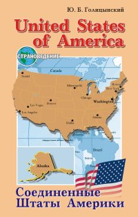
Соединенные Штаты Америки
Покупка
Тематика:
Гуманитарные дисциплины. Школа
Издательство:
КАРО
Автор:
Голицынский Юрий Борисович
Год издания: 2008
Кол-во страниц: 448
Возрастное ограничение: 12+
Дополнительно
Вид издания:
Практическое пособие
Уровень образования:
Среднее общее образование
ISBN: 978-5-9925-0137-7
Артикул: 026324.09.99
Доступ онлайн
350 ₽
В корзину
Пособие посвящено изучению США. Приведены сведения о герографии, истории, знаменитых личностях этой англоязычной страны. Полнота охвата материала и доступная лексика делает его незаменимым для учащихся старших классов гимназий и школ с углубленным изучением английского языка.
Тематика:
ББК:
УДК:
- 373: Дошкольное воспитание и образование. Общее школьное образование. Общеобразовательная школа
- 3731: Учебники и учебные пособия
ОКСО:
- ВО - Бакалавриат
- 44.03.01: Педагогическое образование
- 45.03.01: Филология
- 45.03.02: Лингвистика
ГРНТИ:
Скопировать запись
Фрагмент текстового слоя документа размещен для индексирующих роботов
Ю. Б, Голицынский


                Соединенные
                Штаты Америки


ИЗДАТЕЛЬСТВО СЗЙСР© Санкт-Петербург
УДК 373.167.1:802.0
ББК 81.2 Англ-922
     Г 60


     Голицынский Ю. Б.
Г 60 Соединенные Штаты Америки: Пособие по страноведению. — СПб.: КАРО, 2008.— 448 с., ил. — (Серия «Страноведение»).
         ISBN 978-5-9925-0137-7
         Пособие посвящено изучению США. Приведены сведения о герографии, истории, знаменитых личностях этой англоязычной страны. Полнота охвата материала и доступная лексика делает его незаменимым для учащихся старших классов гимназий и школ с углубленным изучением английского языка.

УДК 373.167.1:802.0
ББК 81.2 Англ-922

ISBN 978-5-9925-0137-7

© КАРО, 2000
Все права защищены
SECTION ONE


            GENERAL INFORMATION


CHAPTER 1 GEOGRAPHICAL SURVEY


        Part 1.  Geographical Position.

   The United States¹ territory consists of three separate parts, different in size, natural features, level of development and population:
   1)    the main part, the United States proper, with an area of 7,800,000 square kilometres. It borders on Canada¹ ² in the north and on Mexico³ in the south. It is washed by the Pacific Ocean⁴ in the west, the Atlantic Ocean⁵ in the east, and the Gulf of Mexico⁶ in the south-east;
   2)    Alaska⁷, which occupies the north-western part of the continent of North America⁸, including a lot of islands;
   3)    Hawaii¹ in the Pacific Ocean.


   ¹ The United States [dsju'naitid'steits] Соединённые Штаты

   ² Canada ['ksnsds] Канада

   ³ Mexico ['meksikou] Мексика

   ⁴ the Pacific Ocean [бэ ps'sifik'oujn] Тихий океан

   ⁵ the Atlantic Ocean [6i эСкепПк'ои|п] Атлантический океан

   ⁶ the Gulf of Mexico [бэ'диК эv'meksIkou] Мексиканский залив

   ⁷ Alaska [э'1^кэ] Аляска

   ⁸ North America ['по:0 э'тепкэ] Северная Америка

3
The United States of America

QUESTIONS.
1.   How many separate parts does the United States of America consist of? What are these parts?
2.   What countries does the United States border on?
3.   What waters is the United States washed by?
4.   Where is Alaska situated?
5.   Where is Hawaii?

    ¹ Hawaii [ha:'waii:] Гавайи

4
        Part 2. Nature.


  The United States is mostly situated in the temperate and subtropical zones. Alaska lies in the subarctic and arctic zones. The southern part of Florida¹ and Hawaii are situated in the tropical zone.
QUESTIONS.
1. What natural zones is the United States situated in?
2. What part of the United States is situated in the arctic zone? What parts are situated in the tropical zone?

        Part 3. Coasts.

  The coastline length of the United States proper is 22,860 km. The Atlantic coast is mostly lowland and greatly indented. The Pacific coast is mountainous, in the northern part cut by numerous fiords.
QUESTIONS.
1. What is the length of the United States’ coastline? 2. How does the Atlantic coast of the United States differ from the Pacific coast?

        Part 4. Relief.

  About half the United States’ territory is covered by plateaus and mountains.
  The eastern part of the country is occupied by the Appalachian Mountains¹ ², which in the north


    ¹ Florida ['florids] Флорида

    ² the Appalachian Mountains [hi^sps'leitjjsn'mauntinz] Аппалачские горы

5
The United States of America. Relief

come close to the Atlantic coast and in the south are separated from it by the Atlantic Lowland¹.
   West of the Appalachians stretch the Central Plains¹ ², the Great Plains³, and the Mexican Lowland⁴.
   The Central Plains are 500-400 m high and have a hilly moraine relief in the north and a more

    ¹ the Atlantic Lowland [61 st'tentik'loubnd] Приатлан-тическая низменность

    ² the Central Plains [ds'sentrsTpleinz] Центральные равнины

    ³ the Great Plains [ds'greit'pleinz] Великие равнины

    ⁴ the Mexican Lowland [ds'meksiksn'loulsnd] Примек-сиканская низменность

6
gentle erosional relief in the middle and southern parts.
   The Great Plains (west of west longitudes DTDS”) are a deeply cut plateau with the heights of 500 m in the east to 1600 m at the Cordillera¹ foothills.
   The flat Mexican Lowland, with the height of up to 150 m, is swampy along the Gulf coast and fringed

by a strip of marsches.
   The western part of the country (including almost the whole of Alaska) is made up of high mountain ranges, tablelands and plateaus of the Cordillera system.
   The Cordilleras consist of rows of mountain ranges with the heights of up to 3000-5000 m and a broad strip of intermountain tablelands and plateaus. In Alaska the mountain ranges stretch in the west-east

Mt. McKinley

direction and include the Brooks Range¹ ², the Yukon Tableland³, the Aleutian Range⁴ with Mount McKinley⁵, 61D3 m — the highest peak of the USA and the whole of North America.

   ¹ the Cordillera [ds.k^di'ljesrs] Кордильеры

   ² the Brooks Range [6s,bruks'remd3] Хребет Брукса

   ³ the Yukon Tableland [ds'juksn'teibllsnd] Юконское плоскогорье

   ⁴ the Aleutian Range [6i s'lujisn'remds] Алеутский хребет

   ⁵ Mount McKinley ['maunt ms'kmli] Гора Мак Кинли

7
   On the territory of the USA proper the mountain ranges stretch in the north-south direction. The first from the east are the Rocky Mountains¹, reaching up to nearly 4400 m. West of the Rockies lie vast plateaus and tablelands: the volcanic Columbia Plateau¹ ², the Great Basin³ — a desert tableland with deep depressions (the largest is the Death Valley⁴, containing the lowest point in the western hemisphere — 86 m below sea level), the Colorado Plateau⁵. Typical for this area is the alternation of tablelands situated at the height of about 2000 m and mountain ranges reaching up to 3000-5000 m, with numerous deep river canyons.
   Further west is a narrow belt of the Cascade Mountains⁶, and the Sierra Nevada⁷ Range (over 4400 m). Still further west lies an area of valleys (Willamette⁸, the Californian Valley⁹).
   The Pacific coast is formed by the deeply cut Coastal Ranges¹⁰ with the height of up to 2400 m.
QUESTIONS.
1. Where are the Appalachian Mountains?

    ¹ the Rocky Mountains [ds'roki'mauntinz] Скалистые горы

    ² the Columbia Plateau [бэ ks'kmbis'ptetou] Колумбийское плато

    ³ the Great Basin [бэ'дгей'Ьекп] Большой бассейн

    ⁴ the Death Valley [бэ'с1е0'\лс1|] Долина смерти

    ⁵ the Colorado Plateau [бэ,ко1э'га:бои plstou] Плато Колорадо

    ⁶ the Cascade Mountains [бэ kcs'keid'mauntinz] Каскадные горы

    ⁷ the Sierra Nevada [бэ si'era пэ'уаДэ] Сьерра Невада

    ⁸ the Willamette [/wiljs'met] Уилламетт

    ⁹ the Californian Valley [<k,kc1i'fb:i^n'vic1i] Калифорнийская долина

    ¹⁰ the Coastal Ranges [<Vkoust1'reind3iz] Береговые хребты 8
2. What is the relief of the United States like to the west of the Appalachian Mountains?
3. What is the relief of the Great Plains like?
4. What is the Mexican Lowland like?
5. What kind of relief does the western part of the country have?
6. What does the Cordillera mountain system consist of?
7. In what direction do the Cordillera mountain ranges stretch?
8. What is the highest peak of the Cordilleras? Where is it?
9. Where are the Rocky Mountains?
10. What is the Great Basin? Which is the largest depression of the Great Basin? What is it called?
11. What is typical of the relief of the Great Basin?
12. Where are the Cascade Mountains and the Sierra Nevada?
13. What is the Pacific coast of the USA like?

        Part 5.  Climate.

   The United States of America occupying a large territory, it is natural that a great diversity of climatic conditions can be observed in different parts of the country. Besides, being crossed by mountain ranges from north to south, the country is unprotected from blasts of cold air from the north and warm air from the south. This is the cause of great fluctuations of temperature.
   The northern part of the Pacific coast enjoys a moderate climate of temperate zones with a cool summer and a rather warm (for these latitudes) winter without a permanent snow cover and an abun

9
dant rainfall on the western slopes of the Cascade Mountains (3000-6000 mm a year).
   The southern part of the Pacific coast (California) has a Mediterranean¹ climate: a hot, cloudless and dry summer and a cool and rainy winter with the mean temperatures of 20-25 °C in summer and 5-10 °C in winter. The rainfall is rather small (400600 mm a year).
   The climate on the Atlantic coast is continentalmarine with cool summers and rather warm winters with a permanent snow cover in mountainous regions. Further to the south the climate gets warmer, with warmer winters and hotter summers, gradually passing into the monsoon subtropical climate in the extreme south and Florida. The temperatures here are comparable to those on the Pacific coast of California, but the rainfall is heavier and occurs mostly in summer.
   The plains of the Appalachian Mountains enjoy a continental climate, with warm summers and cold winters with a permanent snow cover.
   The plateaus and tablelands of the Cordilleras have an extreme continental climate with very cold winters and very hot summers. The highest temperature is observed in the Death Valley (sometimes up to 56 °C).
QUESTIONS.
1. How does the relief of the United States tell on the climatic conditions? What causes great fluctuations of temperature?
2. Characterize the climate of the northern part of the Pacific coast.

   ¹ Mediterranean [ medits'remjsn] средиземноморский 10
Доступ онлайн
350 ₽
В корзину